Saturday, July 15, 2017

Tour at Saint Martin - 2017

St. Martin's Island (Bengali: সেন্ট মার্টিন্স দ্বীপ) is a small island (area only 8 km) in the northeastern part of the Bay of Bengal, about 9 km south of the tip of the Cox's Bazar-Teknaf peninsula, and forming the southernmost part of Bangladesh. There is a small adjoining island that is separated at high tide, called Chera Dwip. It is about 8 kilometres (5 miles) west of the northwest coast of Myanmar, at the mouth of the Naf River.

The first settlement started 250 years ago by Arabian sailors who named the island 'Jazeera'. During British occupation the island was named St. Martin Island. During the First Anglo-Burmese War between the British and Burmese empires in 1824–1826, rival claims to the island were a major factor. The local names of the island are "Narikel jinjira" which means 'Coconut Island' in Bengali, and "Daruchini Dwip". It is the only coral island in Bangladesh.

By Bus: Getting to Saint Martins Island by bus is a two-step process. First you'll need to travel to Teknaf which is the Southern most district of Bangladesh on the very southern tip, sandwiched up against Myanmar. One can come to Teknaf by bus from Dhaka, Chittagong and Cox's Bazar. Dhaka to Teknaf bus fare is around BDT 1000 non-A/C and BDT 2000-2200 A/C as of January, 2017. 

Teknaf to Saint Martin Photo Blog


There are several bus services which depart from Fakirapool, Dhaka to Teknaf. Maximum bus starts at night and the journey is near about 10-11 hours. From Teknaf, mid-level ships run daily and take around 2-2.30 hours named Kutubdia, Keary Sindabad, Keary Dine & Cruise, Eagle-1. The fare starts from BDT 450 to BDT 2500 as of Jan, 2017. All the ships and cruises stars journey from Teknaf to Saint Martin around 9AM-9.30AM and return journey starts from Saint Martin to around 3.00 PM. 


The important thing is, during the off-season (May-August/September) these ships do not provide services because off bad weather. The peak season is September-April. The total distance from Dhaka to the island is 510 km.


Arriving from the port you'll walk through a strip of basic restaurants and shops, and hit a T-junction. Left will take you to the eastern beaches (the cement ends shortly before the scuba dive centre), while a right turn will take you along the main cement 'road' where most of the hotels and guesthouses are, ending at the north-west part of the island.


Food is a little more expensive here than on the mainland.


Village life is slow paced — most work happens in the morning and evening, while midday is reserved for drying fish and rice and selling your coconuts. Or, more likely, sitting in the shade chewing paan.


The food shacks that line the road to the port all cook up similar fare: parothas (Tk 8), omelettes (egg, Tk 20) and vegetable curry (Tk 20) for breakfast, and (fish, dal, rice and veggies at 130 Tk) the rest of the day. Cha is Tk 8.


All of the hotels also have restaurants with basically the same typical Bangladeshi offerings, with higher prices and better quality than those near the port. Chicken is sometimes available but not very tasty, and lobster and crab may be available occasionally at very high prices. The restaurant at Blue Marine Resort and Appayan at St Martin's Resort are the best on the island.


Stars are amazingly plentiful on a moonless night, due to the lack of electricity on the island.


Sunrise on the east side of the island, and after a lazy day head over to the west side for sunset. Sunset Point is a rocky peninsula on the northwest corner of the island, near Saint Martin's Resort, which exists only at low tide — a popular spot if sunset and low tide coincide.


At one point a left turn leads around the newly built hospital and into the centre of the island. It's an interesting walk and eventually leads out to the western beach just north of the Sea Turtle Hatchery, after a couple wrong turns.


Flatbed cycle-rickshaws are the only transport aside from walking. There are no motorized vehicles on the island, not even motorcycles (yay!).

The islanders also sell dried fish, which is a bit more expensive but fresher than those available upshore in Cox's Bazaar.


Early morning is the best time to get fresh fish from the fisherman near the market, you can often bring it to your hotel chef and ask him to fry it up the way you like, or some places may do a nice evening barbeque. Some places may even give you kitchen access to cook it yourself if you ask.

Chera Dwip Photo Blog


Oceanic Scuba Dive Center, (turn left from the pier at the end of the strip of restaurants, it's a couple hundred meters down on the right, unsigned and well-hidden behind a bamboo gate), ☎ +880 2 955 9751 (divebangladesh@yahoo.com), This is the only dive operation in the country, and is run by a friendly group of ex-navy divers. 


At the moment they only visit one site at the southeast of the island (off Chera Dwip), which is unspectacular but still makes for a nice boat ride and the most activity you could hope for during your stay on the island. They're working towards buying a 'German' boat which will allow them to explore sites further out to sea, which may yield some better diving and more sea life. 


Prices are a little high (and negotiable), but consider that you're contributing to these guys' livelihood and towards expanding the opportunity for future diving. They've also got one bamboo guest hut with two beds if you're diving with them, and they'll cook all your meals for you — an alternative to the lackluster budget accommodation on the island. Food and lodging are by donation. 


On a safety note, this is nothing like a PADI certified dive center, and beginners should take care, especially alone — a guide/buddy is not included (though there's a good chance one of the guys will still come down with you). Tk 2000/dive, Tk 500 snorkel gear rental, Tk 600-800 boat fee. 


Walk the beach to the southern island of Chera Dwip, accessible on foot along a narrow strip of land at low tide, or via a boat shuttle (Tk 5/person) at high tide. Beware of sharp rocks if wading through the water; sandals are ideal. Walking the length of the island takes around 1.5 hours. Take some sunscreen and water (though there's an occasional shack selling drinks, coconuts and snacks).


There are many small shops near the dock/port and along the main road selling very basic necessities and the odd souvenir t-shirts, hats, dry fish, shoe, sandals, dry foods, cosmetics & toiletries and sunglasses and many more. These are relatively cheap from the main town. Specially one must buy dry fish from here, it's relatively cheap and high quality. There are also few restaurants along with the main road of Saint Martins Island. The foods are cheap and good quality to eat. Anyone can complete the Breakfast, Lunch and Dinner with various sea foods. Everyone should taste the experience with different sea fishes and food, if once go there.


Sea shells and things made from them are sold by little children around the island, but it's illegal and leads to the depletion of sea life. If any one go there, please not to buy those and encourage others not to buy those. These will slowly damage this Island and the natural life. There are also some fake product come from Myanmar and China. Please try to avoid those and buy the real one.


The island has seen a massive increase in tourism (mostly Bangladeshis) over the last few years, and the fragile ecosystem on the island is not well equipped to handle it. Do what you can to encourage eco-friendly practices, and definitely don't litter the island. It's also a good idea to avoid eating fish at every meal on an island where overfishing is a major problem and sea life is rapidly vanishing.
If you come across sea turtles or their eggs, keep a reasonable distance and don't disturb these fascinating but fragile creatures.

Westerners should be alert to the modest lifestyle of the islanders, especially women. It is not a good idea to swim in public places in western bathing suits, and modest dress is appropriate for both women and men.

Wednesday, October 19, 2016

বান্দরবন মানেই পাহাড়ি পথ ও ঝর্ণার দেশ

বান্দরবান মানেই পাহাড়ের দেশ, বান্দরবান মানেই সবুজের দেশ, বান্দরবান মানেই ঝর্ণার দেশ। আর ঝর্ণা শব্দটাই কেমন যেন রিনিঝিনি ছন্দময় আনন্দময় আবহ জাগায় শরীর ও মনে। ইচ্ছে হয় ওর পানির সৌন্দর্য্য আর শীতলতায় ধুয়ে ফেলি জীবনের সব কালিমা।
** কেওক্রাডং বাংলাদেশের পঞ্চম সর্বোচ্চ পর্বতশৃঙ্গ। এর উচ্চতা ৩১৭২ ফুট। এটি বাংলাদেশের বান্দরবানের রুমা উপজেলায় অবস্থিত। এক সময় এটিই বাংলাদেশের সর্বোচ্চ পর্বতশৃঙ্গ ছিল। যদিও আধুনিক গবেষণায় এই তথ্য ভুল প্রমাণিত হয়েছে। বর্তমানে বাংলাদেশের সর্বোচ্চ শৃঙ্গ সাকাহাফং বা মদক তুং। দূর থেকে কেওক্রাডংয়ের চূড়াকে ধোয়াটে মনে হয়। সাদা মেঘে ঢাকা। হওয়ায় ঝাপটায় দাঁড়ানো দায়। বৃষ্টি–বাতাস-মেঘ সময় সময় দখল নেয় চূড়ার আশপাশ।
Bandarban, keokradang, keo, kewkradang, keokaradang, কেওক্রাডং

**  বগালেক থেকে কেওক্রাডং এর পথে ঘন্টাখানেকের পাহাড়ি পথ পাড়ি দিলেই এই চমৎকার ঝর্ণাটা পাবেন, কিন্তু প্রাথমিকভাবে যেটুকু ঝর্ণা দেখা যায় এটুকুই কিন্তু চিংড়ি ঝর্ণা নয়। আসল টুকু দেখতে হলে আপনাকে বিশাল বিশাল পিচ্ছিল পাথরগুলো পেরিয়ে আর একটু ভেতরে ঢুকে ডান দিকে ৯০ ডিগ্রি ঘুরতে হবে। দেখবেন অসাধারণ একটি ঝর্ণা, যেন বাশ বাগানের মাথার অনেক উপর থেকে একেবেঁকে নেমে আসছে চমৎকার একটা স্রোতধারা।
** সমুদ্র পৃষ্ঠ থেকে প্রায় ২৭০০ ফুট উঁচু পাহাড়ে প্রাকৃতিক ভাবে সৃষ্ট বগা লেক। ভূ-তত্ত্ববিদগণের মতে প্রায় দুই হাজার বছর আগে প্রাকৃতিক ভাবে পাহাড়ের চূড়ায় এই লেক তৈরি হয়। মৃত আগ্নেয়গিরির জ্বালামুখ কিংবা মহাশূন্য থেকে উল্কাপিণ্ডের পতনের ফলে সৃষ্টি হয়েছে। কেওকারাডাং এর কোল ঘেঁষে বান্দারবান শহর থেকে প্রায় ৭০ কিলোমিটার দূরে এবং রুমা উপজেলা সদর থেকে প্রায় ১৫ কিলোমিটার দূরে বগা লেক এর অবস্থান। পাহাড়ের উপরে প্রায় ১৫ একর জায়গা জুড়ে এই লেকের অবস্থান। শান্তজলের হ্রদ আকাশের কাছ থেকে একমুঠো নীল নিয়ে নিজেও ধারন করেছে সে বর্নিল রং। পাহাড়ের চুড়ায় নীল জলের আস্তর নীলকাশের সাথে মিশে তৈরি করেছে এক প্রাকৃতিক কোলাজ। মুগ্ধ নয়তে দেখতে হয় আকাশ পাহাড় আর জলের মিতালী। প্রকৃতি এখানে ঢেলে দিয়েছে একরাশ সবুজের ছোঁয়া। দুর্গম পথ পাড়ি দিয়ে আসার ক্লান্তি হারিয়ে যায় হ্রদের অতলগহ্বরে। সবকিছু মিলে এ যেন এক সুন্দরের লীলাভূমি।
** লুং ফের ভা সাইতার বান্দরবানে অবস্থিত একটি বিশাল ঝর্নার নাম। নাম যেমন কঠিন, এই ঝর্নায় যাওয়ার ট্রেইলও তেমন কঠিন। এখন পর্যন্ত হাতে গোনা মাত্র কয়েকজন মানুষের পা পড়েছে এই ঝর্নায়। থিংদৌলতে পাড়া থেকে ‘তার পি’ ফলসও দেখে আসতে পারবেন। তবে মনে রাখবেন অনেক বিপদজনক ট্রেইল এটা।
ট্রেইলঃ রুমা – বগালেক – কেওক্রাডং – থাইকং পাড়া – থিংদৌলতে পাড়া – সিলোপি পাড়া – লুং ফের ভা সাইতার।
লুং ফের ভা সাইতার, lung far ve saitar, saitar, lung fer va saitar, bandarban

** বান্দরবন (Bandarban) জেলার রুমা বাজার (Ruma Bazar) থেকে নদীপথে থানছি (Thanchi) যাওয়ার পথে পড়বে ঋজুক ঝর্ণা (Rijuk Waterfalls) । মার্মা ভাষায় একে রী স্বং স্বং বলা হয়। রুমা বাজার থেকে এর দূরত্ব প্রায় ৫ কিলোমিটার এবং বান্দরবন সদর হতে ৬৬ কিঃমিঃ। সাঙ্গু নদীর পাড়ে প্রায় ৩০০ ফুট উচু থেকে সারা বছরই এ জলপ্রপাতটির রিমঝিম শব্দে পানি পড়ে। এই জলপ্রপাতে সারা বছর পানি থাকে। তবে বর্ষার সময় ঋজুক সাঙ্গুর বুকে এত বেশি পানি ঢালে যে প্রবল স্রোতের তোড়ে জলপ্রপাতের ধারে পৌঁছতে এমনকি বড় ইঞ্জিনের নৌকাগুলোরও বেগ পেতে হয়। তখন ঋজুকের সৌন্দর্য একেবারেই অন্য রকম। তবে শুকনো সময়েও বেশ ভালো পরিমাণেই যৌবন থাকে তার।
** পাইন্দু সাইতার/ তিনাপ সাইতার বান্দরবানের রোয়াংছড়িতে অবস্থিত যা এখন বাংলাদেশের বৃহত্তম জলপ্রপাত। যেতে হলে হেঁটে পাড়ি দিতে হবে ৪০ কিলোমিটার পথ। আবার সেই পথেই ফিরে আসতে হবে। বম ভাষায় সাইতার শব্দের অর্থ ঝরনা। পরে অবশ্য গিয়ে জানা যায় ঝরনাটির নাম তিনাপ সাইতার।
পাইন্দু সাইতার, তিনাপ সাইতার, paindu saitar, tinap saitar, bandarban

বান্দরবান পৌঁছে বাস থেকে নেমে রোয়াংছড়ির বাসস্ট্যান্ড থেকে লোকাল বাসে যেতে হবে রোয়াংছড়ি। সেখান থেকে গাইড নিয়ে ২৩ কিমি হেঁটে যেতে হবে রনিন পাড়া। রাতে রনিন পাড়ায় থেকে পরের দিন ৪/৫ ঘণ্টা হেটে (হাটার গতি ও স্ট্যামিনার উপর নির্ভর করে সময় বেশি বা সামান্য কম হতে পারে) পাইন্দু খাল ও বিশাল পাহাড় পেরিয়ে যখন চোখের সামনে অকস্মাৎ উদিত হয়, এই তিনাপ সাইতার, সকল কস্ট, বেদনা নিমেষে পরিণত হয়, অদ্ভুত এক ভালোলাগায়, অদ্ভুত এক মাদকময় নেশায়।
পাইন্দু সাইতার, তিনাপ সাইতার, paindu saitar, tinap saitar, bandarban

**বান্দরবান জেলার থানচি উপজেলায় আশ্চর্য সুন্দর নাফাখুম জলপ্রপাতটি অবস্থিত। বান্দরবন হতে ৭৯ কিমি. দুরে অবস্থিত থানচি। এটি একটি উপজেলা। সাঙ্গু নদীর পাড়ে অবস্থিত থানচি বাজার। এই সাঙ্গু নদী ধরে রেমাক্রীর দিকে ধীরে ধীরে উপরে উঠতে হয় নৌকা বেঁয়ে। প্রকৃতি এখানে এত সুন্দর আর নির্মল হতে পারে ভাবাই যায় না। নদীর দুপাশে উচু উচু পাহাড়। সবুজে মোড়ানো প্রতিটি পাহাড় যেন মেঘের কোলে শুয়ে আছে অবলিলায়। কোন কোন পাহাড় এতই উচু যে তার চূড়া ঢেকে আছে মেঘের আস্তরে। থানচি উপজেলার রেমাক্রি স্থানটি সাঙ্গু নদীর উজানে একটি মারমা বসতী। মারমা ভাষায় ‘খুম’ মানে হচ্ছে জলপ্রপাত। রেমাক্রি থেকে তিন ঘন্টার হাঁটা পথ পাড়ি দিয়ে যেতে হয় এই নাফাখুম জলপ্রপাতে। রেমাক্রি খালের পানি প্রবাহ এই নাফাখুম এ এসে বাঁক খেয়ে হঠাৎ করেই নেমে গেছে প্রায় ২৫-৩০ ফুট, প্রকৃতির খেয়ালে সৃষ্টি হয়েছে চমৎকার এক জলপ্রপাত! সূর্যের আলোয় যেখানে নিত্য খেলা করে বর্ণিল রংধনু! ভরা বর্ষায় রেমাক্রি খালের জলপ্রবাহ নিতান্ত কম নয়। প্রায় যেন উজানের সাঙ্গু নদীর মতই।
নাফাখুম, amiakhum, nafakhum, nafa kum, nafa, kum, khum, bandarban

** বান্দরবন যাওয়ার পরিকল্পনা করছেন ? অনেক জায়গা আছে বান্দরবনে ঘুরে দেখার ! এবং একসাথে সবগুলো ঘুরে শেষ করতে পারবেন না। একেক টা জায়গায় যাবার রুট একেকটা। সবগুলোর উপর ভিত্তি করে ১১টি রুট প্ল্যান করা হয়েছে।

এন্ড্রয়েড এপ্লিকেশন/ বান্দরবন গাইড

- বান্দরবন কোথায় কোথায় যাবেন, কিভাবে যাবেন, কত সময় নিবে, খরচ কত পড়বে !
- কার সাথে যোগাযোগ করবেন
- রিলাক্স ট্যুর এর ক্ষেত্রে কোণ স্থান গুলো টার্গেট করবেন
- এডভেঞ্চার ট্যুর, ট্র্যাকিং, হার্ড ট্র্যাকিং এর জন্য কোথায় যাবেন !
- পুরো বান্দরবনের ১১টি রুট প্ল্যান
- যাওয়ার জন্য আপনার যেসব প্রস্তুতি অবশ্যই অবশ্যই নিতে হবে
- মোবাইল নেটওয়ার্ক সহ প্রয়োজনীয় যাবতীয় তথ্য।

Saturday, September 17, 2016

Sylhet/সিলেট ট্যুর গাইড (এন্ড্রয়েড এপ্লিকেশন গাইড)

** সিলেট শহর থেকে গোয়াইন ঘাট যেতে হবে সিএনজি করে, ১/১.৫ ঘন্টা লাগবে, ঘাট থেকে মোটর বোটে করে রাতারগুলে যেতে হবে আরো ২/২.৫ ঘন্টা লাগবে, সেইখান থেকে সোয়াম্প ফরেস্টে ঢুকতে হইলে ডিঙ্গি নৌকা করে বনের ভিতরে ঢুকতে হবে। 
রাতারগুল

** পান্থুমাই, সিলেট শহর থেকে এর দূরত্ব ৪০ কিমি, জাফলং দিয়ে না গিয়ে সিলেটের এয়ারপোর্ট রোড হয়ে সালুটিকর হয়ে গেলে পথ কম হবে । ভারতের মেঘালয় রাজ্যের পাহাড়ের নিচে, একেবারে সীমান্ত ঘেঁষা এই গ্রামটি আসলেই অসাধারণ। 


পান্থুমাই

** বিছানাকান্দি যেতে হলে সর্বপ্রথম আপনাকে নগরীর আম্বরখানা পয়েন্ট যেতে হবে। সেখানে বিমানবন্দর রোডের দিকে সিএনজি স্টেশন আছে। সিএনজি হাদারঘাট নামক জায়গা পর্যন্ত রিজার্ভ করে গেলে ভাল হয়। পাঁচজন মিলে ৪০০টাকায় সাধারণত ভাড়া নেওয়া হয়। তবে মানুষ কম থাকলে ৮০টাকা জনপ্রতিও যাওয়া যায়। বিমানবন্দর পর্যন্ত রাস্তা অনেক সুন্দর। বিমানবন্দর থেকে সালুটিকর রাস্তায় প্রবেশ করলেই রাস্তা চরম খারাপ। পিচ ঢালা কালো রাজপথে একটু পরপরই ভাঙ্গা গর্ত। খারাপ রাস্তা পার হয়েই আপনি একদম গ্রামের ভেতর ঢুকে যাবেন। দেখতে আপনি হাদারঘাট এসে পৌছাবেন। হাদারপার বাজারেই বিছানাকান্দি যাওয়ার নৌকা পাওয়া যায়। 


বিছানাকান্দি 

# সিলেটের উল্লেখযোগ্য টুরিস্ট স্পট সমূহ, কিভাবে যাবেন, কিসে যাবেন্‌ ভাড়া কেমন, কোথায় থাকবেন, কি কি প্রয়োজন তার সব বিস্তারিত ভাবে দেয়া আছে এপ্লিকেশনটিতে।

# টুরিস্ট স্পট এর বাইরে সিলেটে আপনি কোথায় থাকবেন, হোটেল, রিসোর্ট কোথায় কি পাওয়া যায়, কোনটী কোন মানের এবং এগুলোর খরচ কেমন, বুকিং সিস্টেম কি সবটাই পাবেন এই এপ্লিকেশনে।

# প্রত্যেকটি হোটেল রিসোর্টের যোগাযোগ নাম্ভার সহ ওয়েব এড্রেস পাবেন এপস টিতে। 

# ঘুরতে গেলেন অথচ সিলেটের মুখরোচক খাবার খাবেন না তা কি হয় :) এপসটিতে সিলেটের জনপ্রিয় সব হোটেলের, লোকেশন, খাবার ম্যেনু সহ সব তথ্য পাবেন।

আশা করি ভালো লাগবে। এপ্স টি ফোণে রাখুন আর বেরিয়ে পড়ুন সিলেটের উদ্দেশ্যে।

এপ্স ডাউনলোড লিঙ্কঃ Sylhet/সিলেট ট্যুর গাইড
এপ্সটি তৈরি করছেঃ Hello Tech

Sunday, September 4, 2016

মুছাপুর ক্লোজার, কোম্পানীগঞ্জ, নোয়াখালী


মুছাপুর ক্লোজার, কোম্পানীগঞ্জ, নোয়াখালী

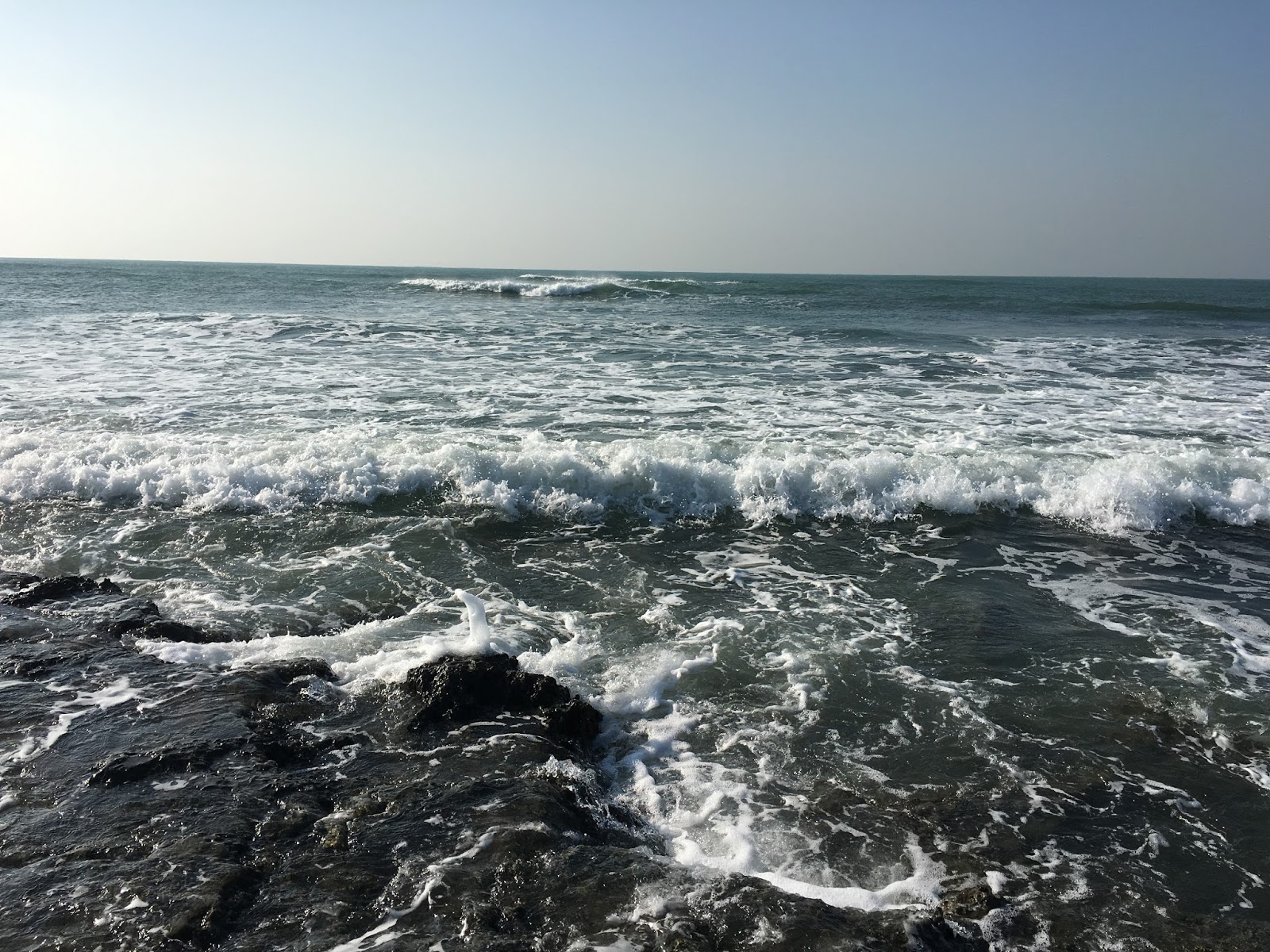
নোয়াখালীর কোম্পানীগঞ্জ উপজেলার দক্ষিণ সীমানায় বঙ্গোপসাগরের একেবারে কোল ঘেঁষে মুছাপুর ক্লোজার ও ছোট ফেনী নদীর অবস্থান। সাগরে যখন জোয়ারের পানি উতলে উঠে তখন অনন্য এক সৌন্দর্য বিকশিত হয় মুছাপুর ক্লোজরের ছোট ফেনী নদীতে।

তটরেখায় আছরে পড়ে ছোট-বড় ঢেউ। প্রায় ৫ কিলোমিটার দৈর্ঘ্য এবং ৩ কিলোমিটার প্রস্থের সমুদ্র সৈকতের যেকোনো জায়গায় দাঁড়িয়ে সূর্যোদয় ও সূর্যাস্ত দেখার সুযোগ রয়েছে। একটু দাঁড়ালেই হারিয়ে যাবেন ঢেউয়ের তালে তালে দুলতে থাকা জেলে নৌকার বহর, সাগরে জেলেদের মাছ ধরার দৃশ্যের মাঝে।

এখানে সবুজ প্রকৃতি, বণ্যপ্রাণী, পাখির ঝাঁক, ফরেস্ট বাগান, ফেনী নদীর মাঝে ক্লোজার, ২৩ ভেন্ট রেগুলেটর, জেলেদের উচ্ছ্বাস আর সাগরের বিস্তীর্ণ জলরাশি মিলে নয়াভিরাম এক সৌন্দর্যের জগৎ সৃষ্টি হয়েছে। প্রকৃতির অপরূপ সৃষ্টি এই মুছাপুর ক্লোজার পর্যটনের সম্ভাবনাময় দ্বার খুলে দিতে পারে।

মুছাপুর ক্লোজার, কোম্পানীগঞ্জ, নোয়াখালী

বর্তমানে এখানে নোয়াখালী ও পার্শ্ববর্তী ফেনী জেলার হাজার হাজার প্রকৃতি প্রেমীদের উপচেপড়া ভিড় দেখা যায়। সকাল হলেই বিভিন্ন স্থান থেকে দর্শণার্থীরা মোটরসাইকেল, সিএনজি, প্রাইভেট কার, মাইক্রোবাস, পিকআপ নিয়ে চলে আসে মুছাপুর ক্লোজারের ছোট ফেনী নদীর তীরে। বিভিন্ন কলেজ ও বিদ্যালয়গুলোর শিক্ষার্থীরা বনভোজনের জন্য মাইক, বাদ্ধ্যযন্ত্র নিয়ে আসে। নব দম্পতিরা নদীর পাড়ে ও ফরেস্ট বাগানে প্রকৃতিক সৌন্দর্যের জগতে হারিয়ে যায়। ইতোমধ্যে মুছাপুর ক্লোজারটি পর্যটন কেন্দ্র করার জন্য উপজেলার বনবিভাগ কর্মকর্তা (রেঞ্জ) ২০১৫ সালে প্রধান বন সংরক্ষক বরাবরে প্রস্তাবনা পাঠানো হয়েছে।
মুছাপুর ক্লোজার, কোম্পানীগঞ্জ, নোয়াখালী

যেভাবে যাবেন : নোয়াখালী জেলা শহর থেকে যেকোনো গাড়িতে প্রথমে কোম্পানীগঞ্জ উপজেলার বসুরহাট বাজারে চলে আসতে হবে। বসুরহাট বাজার থেকে মুছাপুর ক্লোজার পর্যন্ত দুই-তিনটি পাকা সড়ক রয়েছে। ওই সড়কগুলোর যেকোনো একটি দিয়ে চলে যেতে পারেন মুছাপুর।

বিচ্ছিন্ন এ মুছাপুর ক্লোজারের প্রাণকেন্দ্র থেকে ট্রলারে দক্ষিণে যাওয়ার সময় দেখা যায় বনবিভাগের ফরেস্ট বাগানটি দাঁড়িয়ে আছে। বাড়তি এক প্রাকৃতিক সৌন্দর্যের শোভাবর্ধন করে পর্যটন কেন্দ্র সৃষ্টির আশায়। চারপাশে মাথা উঁচু করে দাঁড়িয়ে আছে বিভিন্ন রকমের বনজ গাছ নিয়ে। এইখানে আসলে বিভিন্ন প্রজাতির পাখির কোলাহল, বিশাল সমুদ্র সৈকত, সূর্যোদয় ও সূর্যাস্তসহ নানান মনোরম দৃশ্য উপভোগ করা যায়। পর্যটক ও প্রকৃতিপ্রেমীরা ইচ্ছা করলে এ চরে এসে ঘুরে যেতে পারেন।
মুছাপুর ক্লোজার, কোম্পানীগঞ্জ, নোয়াখালী

মুছাপুর ফরেস্ট বনাঞ্চল : মুছাপুর ক্লোজার এলাকায় চরের মধ্যে দক্ষিণ মুছাপুর মৌজায় ৮শ ২১ দশমিক ৫৭ একর, চরবালুয়া (দিয়ারা) মৌজায় ১ হাজার ৮শ ৬১ দশমিক ১০ একর ও চরবালুয়া মৌজায় ৬শ দশমিক ১৫ একর সর্ব মোট ৩হাজার ২শ ৮২ দশমিক ৮২একর বনবিভাগের জমি জুড়ে মনোরম বনাঞ্চল রয়েছে। এর মধ্যে মুছাপুর ফরেস্ট বাগানটি অন্যতম। এই ফরেস্ট বাগানে রয়েছে ঝাউ, কেওড়া, পিটালী, খেজুর, লতাবল, গেওয়া, শনবলই, বাবুলনাটাই, আকাশমনিসহ বিভিন্ন প্রজাতির মূল্যবান গাছ।

এখানে রয়েছে ঘুঘুসহ বিভিন্ন দেশীয় প্রজাতির পাখির অভয়স্থল। শীতের মৌসুমে সুদুর থেকে আসা অতিথি পাখিরাও এখানে আসতে ভুল করে না। এখানে পরিকল্পিতভাবে ফরেস্ট বাগানটি শুরু হয় ১৯৬৯ সালে। 

কোনো হিংস্র পশুর ভয় না থাকলেও বনে রয়েছে শিয়াল, বন বিড়াল ও সাপসহ বিভিন্ন প্রজাতির পশু ও পাখি। তবে সাপগুলো নিশাচর। এছাড়া বন্য মহিষ, গরু, ভেড়াও দেখা যায়। এই বাগানের মধ্যে দিয়ে বয়ে যাওয়া সরু রাস্তা ধরে হাঁটতে হাঁটতে একটু ভেতরে প্রবেশ করলে মনে হবে এ যেন আরেকটি ভূবন। বনের ভেতরেই প্রাকৃতিকভাবে সৃষ্ট একখণ্ড শীতল ছায়াবিশিষ্ট মাঠ। 

ইচ্ছে করলে এখানে একটু জিরিয়ে নেয়া যায়। পাশে রয়েছে বিশাল সমুদ্র সৈকত। পর্যটক ও প্রকৃতিপ্রেমীরা ইচ্ছা করলে এ মুছাপুর ক্লোজারে এসে ভ্রমণ উপভোগ করতে পারেন। দেশি-বিদেশি ভ্রমণপিপাসুদের তৃষ্ণা মেটাতে মুছাপুর ক্লোজার একটি মনোরম অবকাশ কেন্দ্র।

Tuesday, August 9, 2016

সাজেক ভ্রমণের এন্ড্রয়েড এপ্লিকেশন গাইড

সাজেক ইউনিয়ন (ইংরেজি: Sajek Union), বাঘাইছড়ি উপজিলার রাঙামাটি জিলায়। আয়তন: ৪৩,৭৭৬ একর (বর্গ কিলোমিটার)।
খাগড়াছড়ির দিঘীনালা থেকে মারিশ্যা রাস্তার উপর দিয়ে কাচালাং পার হয়ে মাচালাং হয়ে রুইলুই পাড়ায় রাঙ্গামাটির বাঘাইছড়ি উপজেলার সবচেয়ে বড় ইউনিয়ন সাজেক ভ্যালীতে আসতে হবে। সাজেকে কি আছে যা নিয়ে এত হাউ কাউ? সাজেকের পাহাড় চূঁড়া থেকে মিজোরামের লুসাই পাহাড়ের অদ্ভুত দৃশ্য দেখে সকল ক্লান্তি ও কষ্ট নিমিষেই মিলিয়ে যায় ।

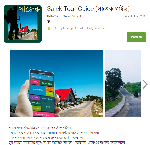
সাজেক সম্পর্কে বিস্তারিত তথ্য দেয়া হয়েছে এপ্লিকেশনটিতে।
  • কিভাবে যেতে হয়
  • কোন যাতায়াতের ভাড়া কেমন
  • সর্বমোট বাজেট কেমন লাগতে পারে
  • কোথায় থাকার ব্যবস্থা আছে
  • পাহাড়ি মাচায় থাকতে হলে কি করতে হবে
  • ট্যুর গাইডের জন্য
  • রিসোর্ট বুকিং এর জন্য কার সাথে যোগাযোগ করতে হবে –এই তথ্য গুলো আছে এপ্লিকেশনটিতে।

যারা সাজেক ঘুরে এসেছে তাদের মতামত, এবং সাজেক ঘুরতে গিয়ে আরো কোন কোন জায়গাগুলো দেখে আসতে পারেন, যা অনেকেই জানেন না সেসবের ঠিকানা দেয়া হয়েছে। আশা করি ভালো লাগবে আপনাদের। ধন্যবাদ।

এপ্স ডাউনলোড লিঙ্কঃ Sajek Tour Guide (সাজেক গাইড)
এপ্সটি তৈরি করছেঃ Hello Tech

সাজেক নিয়ে আমার আগের ব্লগ দেখতে পারেন-

এছাড়াও খাগড়াছড়ি নিয়ে ব্লগ দেখে নিতে পারেন-
অথবা আমার পেইজে দেখতে পারেনঃ Rono’s Traveling
#baghaichori, #chittagong, #khagrachori, #sajek, #sajek valley, #সাজেক #rangamati #dighinala #rocksajek #runmoy #resort #sajekvalley

সাফাত আল মামুন রণ
০৯/০৮/২০১৬

Tuesday, July 12, 2016

Annapurna Base Camp (ABC) Instagram Photo Blog

Annapurna Base Camp (ABC), also called the Annapurna Sanctuary, is one of the premier treks in the Himalaya.  The trek itself provides easy walking, majestic scenery and a mix of cultures unmatched by any other trek in Nepal. The highlights of ABC trek include amazing views of Mt. Machapuchare (6993m.), Mt. Dhulagiri (8167m.) and Mt. Annapurna South (7219m.).  The trail to ABC is well marked and winds through oak and rhododendron forests in a sub-tropical valley and finishes in an amphitheatre of glaciated alpine zone.  The trek leads us to the famous viewpoint of Poon Hill, where you are rewarded with 360-degree view of the Annapurna range at sunrise.  We eventually make our way to Machapuchare Base Camp where we will stay before ascending to the alpine mountain sanctuary of Annapurna Base Camp (4130m.).  ABC is one of the premire treks in the world!

** The setting of Annapurna Base Camp at 4130 m is unique and incredibly spectacular, set amidst the majestic peaks of Annapurna I (8091 m), Annapurna South (7219 m), Machapuchhre (6993 m) and Hiunchuli (6441 m).

Best of ABC

Mountain scenery is the main attraction point of Annapurna Base Camp Trek. However, there are also several other attractions which are equally incredible to the mountain scenery. These attractions are listed below:

  • Mountain views during the day in the Annapurna region are amazing enough but if you plan your trek carefully and reach Annapurna Base Camp during a full moon night then you can witness the majestic mountains glowing under the soothing moonlight.
  • Chhromrung’s Mothers’ group organizes evening cultural program which gives a peek into authentic Gurung culture.
  • During late October to November, raptors mostly eagles migrate westward through Australian Base Camp, a part of Annapurna region.
  • Side trip to Poon Hill from ghorepani is an unmissable trip as you can view multiple mountain ranges such as Dhaulagiri and Annapurna from a single spot.
  • Ghandruk, a perfect place to stop and rejuvenate yourself for the trek ahead, is a picturesque Gurung village which has a calm and serene environment.
 safatrono24

DAY 1: Dhaka to KTM

Kathmandu

Kathmandu

Kathmandu

Kathmandu

Kathmandu

Kathmandu

Kathmandu

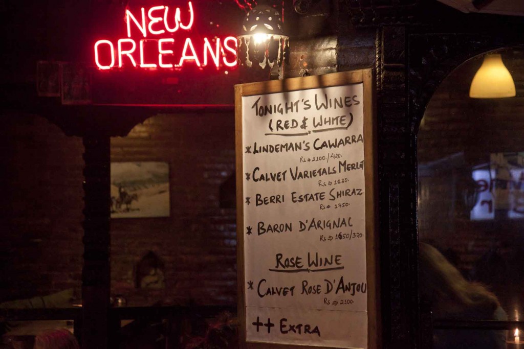
Hotel New Orlance, Kathmandu

Hotel New Orlance, Kathmandu

Hotel New Orlance, Kathmandu

Nirvana Art Gallery, Kathmandu

Hotel New Orlance, Kathmandu

DAY 2: KTM to Pokhara


#pokhara #pokharanepal #teatime

#rainyday #pokharanepal


#pokharanepal #dinner


#pokharanepal #dinner #ifter


#pokharanepal #dinner #ifter


#pokharanepal #dinner #sehri


#travellog #nepal #annapurna #annapurnabasecamp

DAY 3: Nayapul-Chimche-Grandruk-Komorong-Kimrong-Chomorong


#trek #selfie #nayapul #nepal #starttrekking #trekkingday


#nayapul #nepal #abctrekking #abctrek


#nayapul #nepal #abctrekking #abctrek


#nayapul #nepal #abctrekking #abctrek


#nayapul #nepal #abctrekking #abctrek


#nayapul #nepal #abctrekking #abctrek


#nayapul #nepal #abctrekking #abctrek


#nayapul #nepal #abctrekking #abctrek


#nayapul #nepal #abctrekking #abctrek


#nayapul #nepal #abctrekking #abctrek


#nayapul #nepal #abctrekking #abctrek #foodies #breakfast


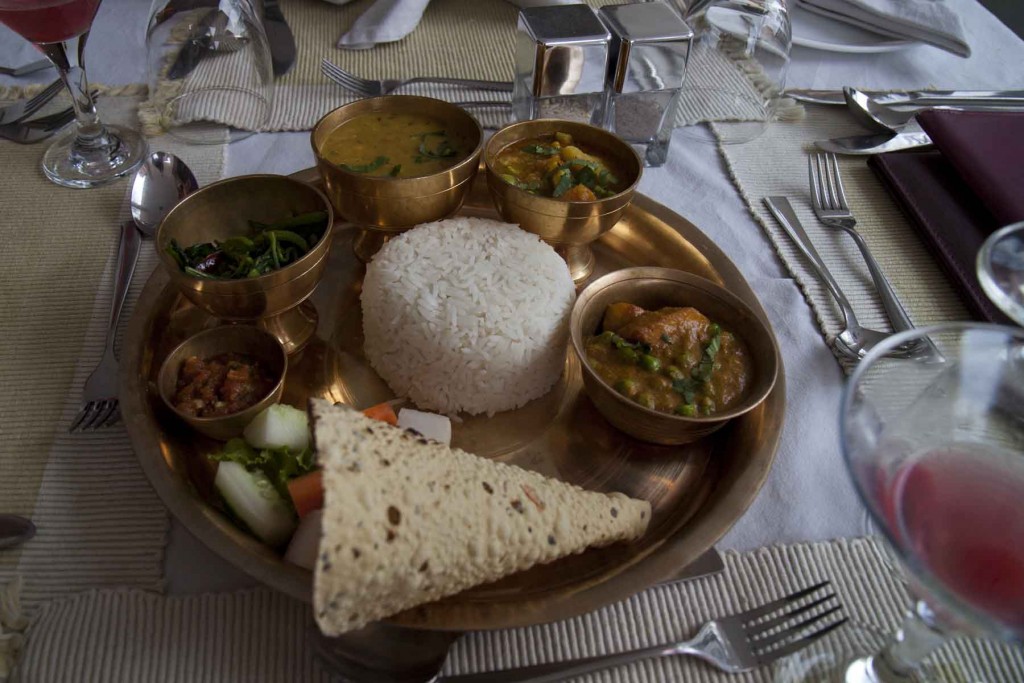
#nayapul #nepal #abctrekking #abctrek #foodies #lunch


#nayapul #nepal #abctrekking #abctrek #foodies #lunch

#nayapul #nepal #abctrekking #abctrek 


#nayapul #nepal #abctrekking #abctrek #foodies #lunch


#nayapul #nepal #abctrekking #abctrek


Nayapul-chimche-grandruk-komorong-kimrong-chomorong.
Now headed to chomorong

#nayapul #nepal #abctrekking #abctrek #foodies #lunch #pokhara


#nayapul #nepal #abctrekking #abctrek #foodies #lunch #breakfast

#trek #abctrekking #abctrek #dovan #bamboo #mbctrek #MBC #Deurali #annapurna #chhomrong #mbctrekking #nepali #nepal #poonhill #poonhilltrek


#trek #abctrekking #abctrek #dovan #bamboo #mbctrek #MBC #Deurali #annapurna #chhomrong #mbctrekking #nepali #nepal #poonhill #poonhilltrek


#trek #abctrekking #abctrek #dovan #bamboo #mbctrek #MBC #Deurali #annapurna #chhomrong #mbctrekking #nepali #nepal #poonhill #poonhilltrek


#trek #abctrekking #abctrek #dovan #bamboo #mbctrek #MBC #Deurali #annapurna #chhomrong #mbctrekking #nepali #nepal #poonhill #poonhilltrek

Nayapul-chimche-grandruk-komorong-kimrong-chomorong.
Now headed to chomorong

#nayapul #nepal #abctrekking #abctrek #foodies #lunch #day3 


Nayapul-chimche-grandruk-komorong-kimrong-chomorong.

#nayapul #nepal #abctrekking #abctrek #foodies #lunch #day3


Nayapul-chimche-grandruk-komorong-kimrong-chomorong. Night stay at chhomrang! Beautiful Nepal

#nayapul #nepal #abctrekking #abctrek #foodies #lunch #day3


Nayapul-chimche-grandruk-komorong-kimrong-chomorong.
Now headed to chomoron,
Cross the river towards chomrong!

#nayapul #nepal #abctrekking #abctrek #foodies #lunch #day3


Nayapul-chimche-grandruk-komorong-kimrong-chomorong. Night stay at chhomrang! Beautiful Nepal

#nayapul #nepal #abctrekking #abctrek #foodies #lunch #day3


Nayapul-chimche-grandruk-komorong-kimrong-chomorong.

#nayapul #nepal #abctrekking #abctrek #foodies #lunch #day3

DAY 4: Chhomrong- Lower Sinuwa- Upper Sinuwa- Bamboo-Dovan


Nayapul-chimche-grandruk-komorong-kimrong-chomorong

#annapurna
#annapurnabasecamp #nayapul #nepal #abctrekking #abctrek #chomrong

Good Morning from Chomrong, Nepal

#trek #abctrekking #abctrek #dovan #bamboo #mbctrek #MBC #Deurali #annapurna #chhomrong #mbctrekking #nepali #nepal #poonhill #poonhilltrek

Good Morning

#trek #abctrekking #abctrek #dovan #bamboo #mbctrek #MBC #Deurali #annapurna #chhomrong #mbctrekking #nepali #nepal #poonhill #poonhilltrek


#trek #abctrekking #abctrek #dovan #bamboo #mbctrek #MBC #Deurali #annapurna #chhomrong #mbctrekking #nepali #nepal #poonhill #poonhilltrek


#trek #abctrekking #abctrek #dovan #bamboo #mbctrek #MBC #Deurali #annapurna #chhomrong #mbctrekking #nepali #nepal #poonhill #poonhilltrek

Only 3 Mountain to go :D


#trek #abctrekking #abctrek #dovan #bamboo #mbctrek #MBC #Deurali #annapurna #chhomrong #mbctrekking #nepali #nepal #poonhill #poonhilltrek

Only 3 Mountain to go :D


#trek #abctrekking #abctrek #dovan #bamboo #mbctrek #MBC #Deurali #annapurna #chhomrong #mbctrekking #nepali #nepal #poonhill #poonhilltrek

Only 3 Mountain to go :D


#trek #abctrekking #abctrek #dovan #bamboo #mbctrek #MBC #Deurali #annapurna #chhomrong #mbctrekking #nepali #nepal #poonhill #poonhilltrek

Only 3 Mountain to go :D


#trek #abctrekking #abctrek #dovan #bamboo #mbctrek #MBC #Deurali #annapurna #chhomrong #mbctrekking #nepali #nepal #poonhill #poonhilltrek

Only 3 Mountain to go :D


#trek #abctrekking #abctrek #dovan #bamboo #mbctrek #MBC #Deurali #annapurna #chhomrong #mbctrekking #nepali #nepal #poonhill #poonhilltrek


#trek #abctrekking #abctrek #dovan #bamboo #mbctrek #MBC #Deurali #annapurna #chhomrong #mbctrekking #nepali #nepal #poonhill #poonhilltrek

Descending stairs from Chhomrong, hiking to Annapurna Base Camp.


#trek #abctrekking #abctrek #dovan #bamboo #mbctrek #MBC #Deurali #annapurna #chhomrong #mbctrekking #nepali #nepal #poonhill #poonhilltrek

Kaski Bridge


#trek #abctrekking #abctrek #dovan #bamboo #mbctrek #MBC #Deurali #annapurna #chhomrong #mbctrekking #nepali #nepal #poonhill #poonhilltrek

Ready to trek


#trek #abctrekking #abctrek #dovan #bamboo #mbctrek #MBC #Deurali #annapurna #chhomrong #mbctrekking #nepali #nepal #poonhill #poonhilltrek

Ready to trek

#trek #abctrekking #abctrek #dovan #bamboo #mbctrek #MBC #Deurali #annapurna #chhomrong #mbctrekking #nepali #nepal #poonhill #poonhilltrek

#trek #abctrekking #abctrek #dovan #bamboo #mbctrek #MBC #Deurali #annapurna #chhomrong #mbctrekking #nepali #nepal #poonhill #poonhilltrek

Chhomrong- Lower Sinuwa- Upper Sinuwa- Bamboo-Dovan

#trek #abctrekking #abctrek #dovan #bamboo #mbctrek #MBC #Deurali #annapurna #chhomrong #mbctrekking #nepali #nepal #poonhill #poonhilltrek

Chhomrong- Lower Sinuwa- Upper Sinuwa- Bamboo-Dovan

Dovan Lodge

Preparing for day 3 trekking, will be headed to MBC.

#trek #abctrekking #abctrek #dovan #bamboo #mbctrek #MBC #Deurali #annapurna #chhomrong #mbctrekking #nepali #nepal

#trek #abctrekking #abctrek #dovan #bamboo #mbctrek #MBC #Deurali #annapurna #chhomrong #mbctrekking #nepali #nepal

#trek #abctrekking #abctrek #dovan #bamboo #mbctrek #MBC #Deurali #annapurna #chhomrong #mbctrekking #nepali #nepal

#Machhapuchhre Base Camp (3700m) 

#trek #abctrekking #abctrek #dovan #bamboo #mbctrek #MBC #Deurali #annapurna #chhomrong #mbctrekking #nepali #nepal

#Machhapuchhre Base Camp (3700m)

Dovan- Deurali-MBC


DAY 5: MBC- ABC

#trek #abctrekking #abctrek #dovan #bamboo #mbctrek #MBC #Deurali #annapurna #chhomrong #mbctrekking #nepali #nepal

#Machhapuchhre Base Camp (3700m)

Dovan- Deurali-MBC

#annapurnabasecamp (4310m)

#trek #abctrekking #abctrek #dovan #bamboo #mbctrek #MBC #Deurali #annapurna #chhomrong #mbctrekking #nepali #nepal

#annapurnabasecamp (4310m)

#trek #abctrekking #abctrek #dovan #bamboo #mbctrek #MBC #Deurali #annapurna #chhomrong #mbctrekking #nepali #nepal


DAY 6: ABC


#annapurnabasecamp (4310m)

#trek #abctrekking #abctrek #dovan #bamboo #mbctrek #MBC #Deurali #annapurna #chhomrong #mbctrekking #nepali #nepal


#annapurnabasecamp (4310m)

#trek #abctrekking #abctrek #dovan #bamboo #mbctrek #MBC #Deurali #annapurna #chhomrong #mbctrekking #nepali #nepal


#annapurnabasecamp (4310m)

#trek #abctrekking #abctrek #dovan #bamboo #mbctrek #MBC #Deurali #annapurna #chhomrong #mbctrekking #nepali #nepal


#annapurnabasecamp (4310m)

#trek #abctrekking #abctrek #dovan #bamboo #mbctrek #MBC #Deurali #annapurna #chhomrong #mbctrekking #nepali #nepal


#annapurnabasecamp (4310m)

#trek #abctrekking #abctrek #dovan #bamboo #mbctrek #MBC #Deurali #annapurna #chhomrong #mbctrekking #nepali #nepal


#annapurnabasecamp (4310m)

#trek #abctrekking #abctrek #dovan #bamboo #mbctrek #MBC #Deurali #annapurna #chhomrong #mbctrekking #nepali #nepal

#annapurnabasecamp (4310m)

#trek #abctrekking #abctrek #dovan #bamboo #mbctrek #MBC #Deurali #annapurna #chhomrong #mbctrekking #nepali #nepal


#annapurnabasecamp (4310m)

#trek #abctrekking #abctrek #dovan #bamboo #mbctrek #MBC #Deurali #annapurna #chhomrong #mbctrekking #nepali #nepal


#annapurnabasecamp (4310m)

#trek #abctrekking #abctrek #dovan #bamboo #mbctrek #MBC #Deurali #annapurna #chhomrong #mbctrekking #nepali #nepal


#annapurnabasecamp (4310m)

#trek #abctrekking #abctrek #dovan #bamboo #mbctrek #MBC #Deurali #annapurna #chhomrong #mbctrekking #nepali #nepal


#annapurnabasecamp (4310m)

#trek #abctrekking #abctrek #dovan #bamboo #mbctrek #MBC #Deurali #annapurna #chhomrong #mbctrekking #nepali #nepal


#annapurnabasecamp (4310m)

#trek #abctrekking #abctrek #dovan #bamboo #mbctrek #MBC #Deurali #annapurna #chhomrong #mbctrekking #nepali #nepal


#annapurnabasecamp (4310m)

#trek #abctrekking #abctrek #dovan #bamboo #mbctrek #MBC #Deurali #annapurna #chhomrong #mbctrekking #nepali #nepal

DAY 7: ABC-DOVAN

#trek #abctrekking #abctrek #dovan #bamboo #mbctrek #MBC #Deurali #annapurna #chhomrong #mbctrekking #nepali #nepal


#trek #abctrekking #abctrek #dovan #bamboo #mbctrek #MBC #Deurali #annapurna #chhomrong #mbctrekking #nepali #nepal


#trek #abctrekking #abctrek #dovan #bamboo #mbctrek #MBC #Deurali #annapurna #chhomrong #mbctrekking #nepali #nepal

 DAY 8: DOVAN- BAMBOO-CHOMRONG-JHINU

#trek #abctrekking #abctrek #dovan #bamboo #mbctrek #MBC #Deurali #annapurna #chhomrong #mbctrekking #nepali #nepal


#annapurnabasecamp (4310m)

#trek #abctrekking #abctrek #dovan #bamboo #mbctrek #MBC #Deurali #annapurna #chhomrong #mbctrekking #nepali #nepal

 DAY 9: JHINU-HOT SPRING-NEW BRIDGE-SIOWA-POKHARA

#trek #abctrekking #abctrek #dovan #bamboo #mbctrek #MBC #Deurali #annapurna #chhomrong #mbctrekking #nepali #nepal


#trek #abctrekking #abctrek #dovan #bamboo #mbctrek #MBC #Deurali #annapurna #chhomrong #mbctrekking #nepali #nepal 

MISS YOU ANNAPURNA, NEPAL


Annapurna Sanctuary/Annapurna Circuit at a glance for Better View/Understanding(Collected)

Annapurna Massif Aerial View

Annapurna II


Annapurna III

Hiunchuli

Annapurna Dakshin/South

Gangapurna

Gangapurna
Annapurna I
Nilgiri North